Station 1
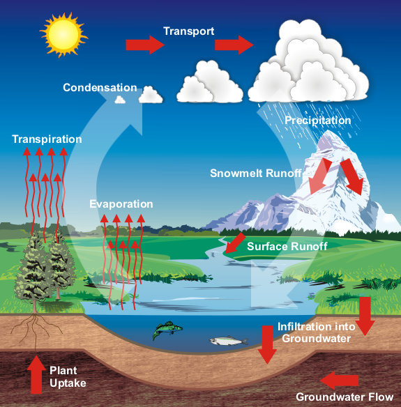
The Water Cycle:
Draw a simple diagram of the water cycle.
Label with words: Evaporation, Condensation, Precipitation, Runoff, Infilitration
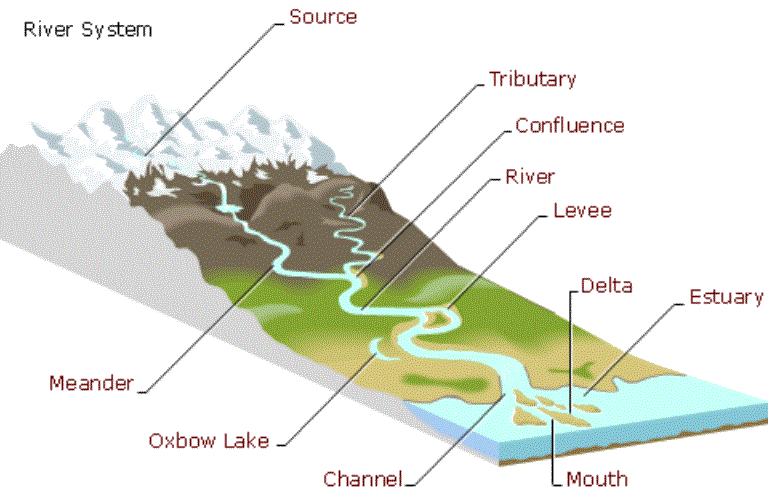
Station 2
Draw a a river system (see picture below):
Label: Watershed, Divide, Meandering River, Cutbank + Point Bar, Floodplain, Tributary, Delta and an Oxbow Lake.
Label: Watershed, Divide, Meandering River, Cutbank + Point Bar, Floodplain, Tributary, Delta and an Oxbow Lake.
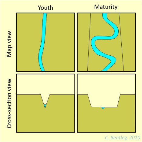
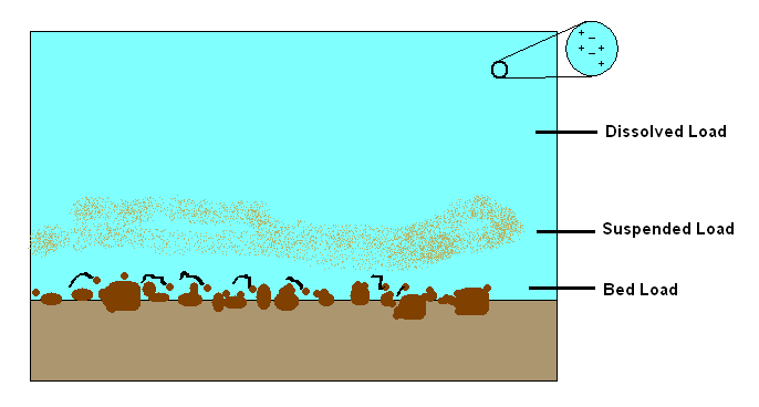
Station 3
Illustrate/describe differences in a YOUNG river vs. an OLD river.
Use the words: Downcutting, Meandering, headward, Bedload, Suspended load, Dissolved load
Use the words: Downcutting, Meandering, headward, Bedload, Suspended load, Dissolved load
|
|
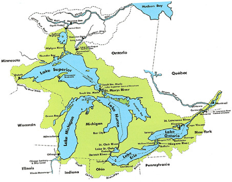
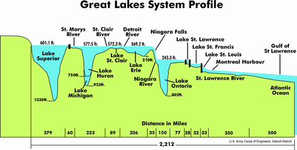
Station 4
Draw the Great Lakes, and show the path water takes. Start with Lake Superior and end with the Atlantic Ocean.
|
|
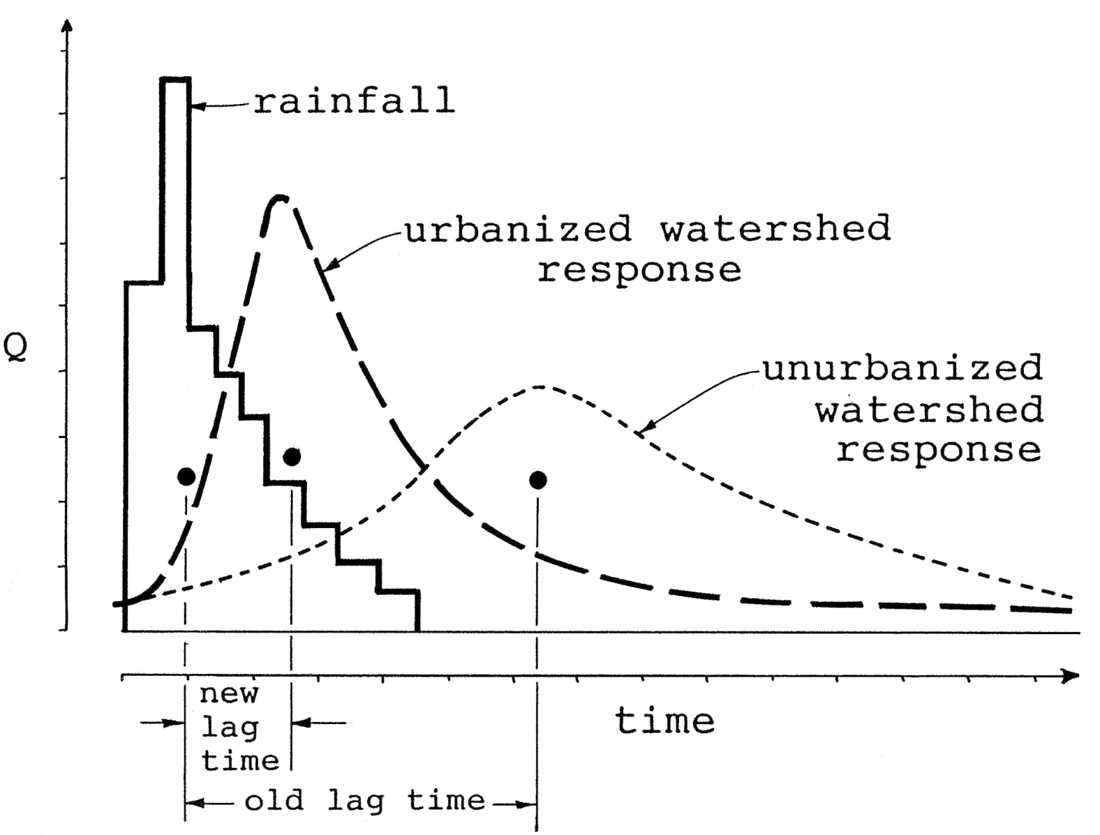
Station 5
Illustrate flooding in Urban (city) vs. Rural (country) areas: use the word Lag Time in your picture.
|
Station 6
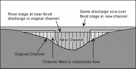
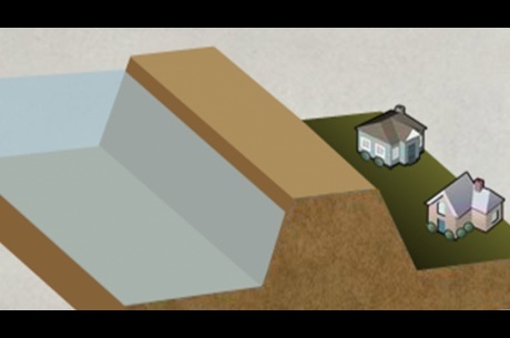
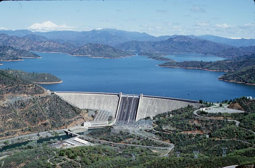
Illustrate the 3 ways to prevent flooding: Channelization, Levee's, Dam's
|
|
|
Station 7
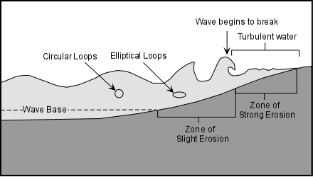
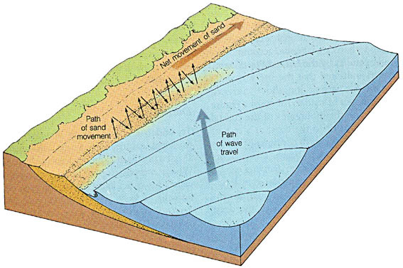
Illustrate how waves become breakers.
+
Illustrate on same picture, Long-Shore Drift
+
Illustrate on same picture, Long-Shore Drift
|
|
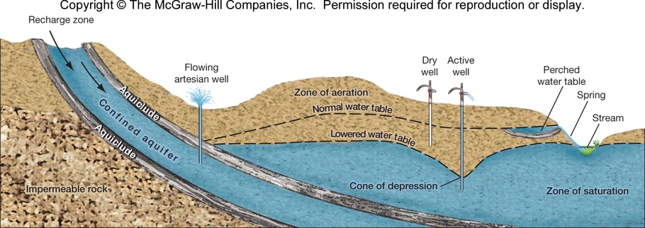
Station 8
Illustrate ground water
Include the words: Zone of Aeration, Water Table, Zone of Saturation, Porosity and Permeability, Ordinary Well and Artesian Well
Include the words: Zone of Aeration, Water Table, Zone of Saturation, Porosity and Permeability, Ordinary Well and Artesian Well